Adventure has been lacking of late. Eating and drinking have been winning out. After a week in a convention centre, barely seeing daylight, it was time to go for it. From the local paragliding chat groups it seemed pretty much everyone had given the 3 Peaks a go over recent weeks!
It is a hefty challenge when not particularly fit and carrying a paraglider. A distance to cover of over 21 miles with approximately 1500m in vertical ascent. I have hiked them all in the past – but the car parks for Skirrid and Sugar Loaf are actually quite high up the hill side compared to the valley bottom, and you normally only do one of them.
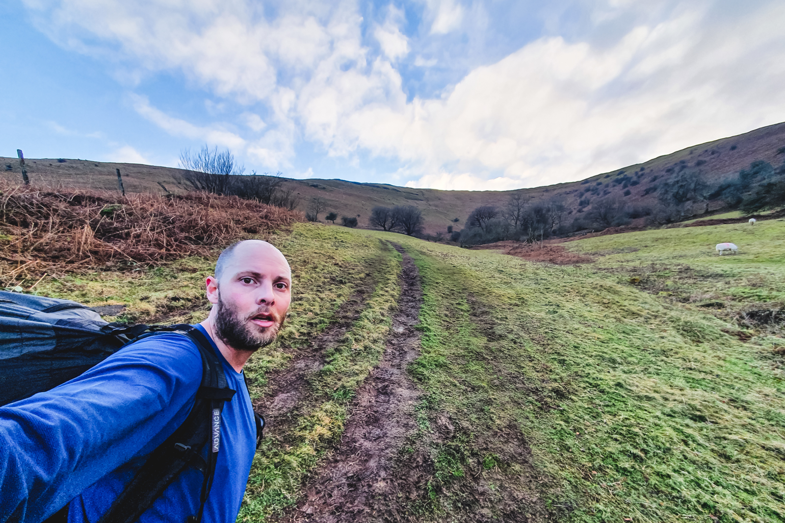
I started around half ten – and instantly realised I had no idea how to get to the first peak – Skirrid. I got lost in a housing estate and ended up going a round about way. I was dressed way too warm for speed hiking with a big backpack, so quickly stripped down. Not the best start. Once I actually made it to Skirrid I recognised the way and off I went.
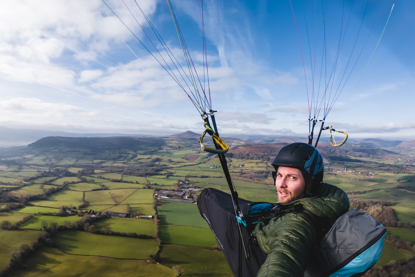
Never having flown off Skirrid and being alone meant I had to figure it out by myself. The air was pretty still, so I laid out the wing just below the trig point and prepared for my first forward launch in a long time. Running off a cliff is always a bit daunting but it went well enough and I was on my way to Sugar Loaf.


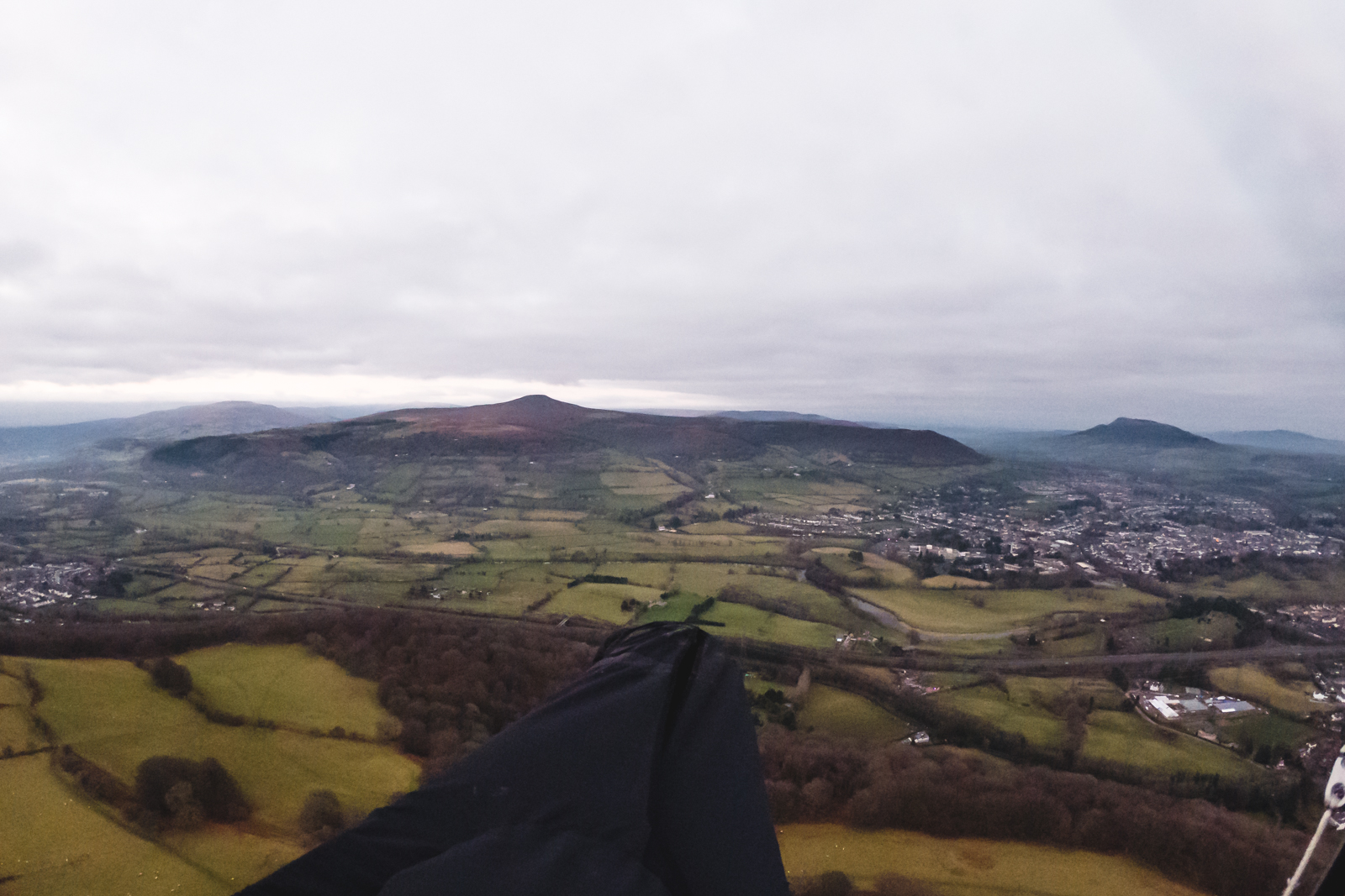
The 2 key obstactles I really wanted to clear were the main road first, and then a train line. Finding a hiking route across these could waste a lot of time. I cleared them both but soon saw a load of over head wires and trees so I picked a field with a gate onto a road and landed. It went as well as I could hope for.
I was slow packing up again – lack of practice. However the easy access to the road set me in good stead for getting up Sugar Loaf. As I tackled my second big climb of the day I could feel the legs. The path was pretty easy going though and only the last climb was that steep. Once on top it became apparent the wind was not blowing in a good direction and it was rammed with people. Neither ideal for experimental paraglider launches. I opted to walk down and try to take off further down.
The idea of walking down hills is pretty painful when carrying a wing. I was desperately looking for somewhere to take off but again having never taken off on Sugar Loaf it was a case of keeping an eye out. Suddenly I saw a couple of wings take off. I had caught up with a group doing the same route. I saw their launch spot and prepared to fly. The wind was blowing from the side which is not helpful, but it was do-able, and much better than walking down.
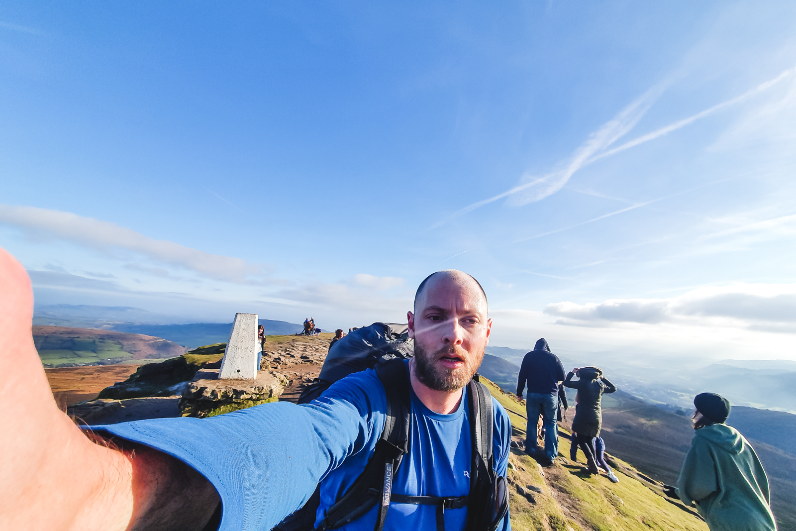
The aim was the bridge crossing the river but I did not have a good enough glide. I landed a couple of fields short. I packed up and headed off. Navigating to the bridge was easy enough and I soon found the underpass under the busy main road. After that I got lost again in another housing estate. I knew the trail started somewhere but I couldn’t remember where. I walked in the wrong direction for a bit before eventually getting back onto the right trail. From there on it was a very slow and steady slog up to the top of the Blorenge. It is very steep in places and my legs were burning. I had brought nowhere near enough water with me for the day.
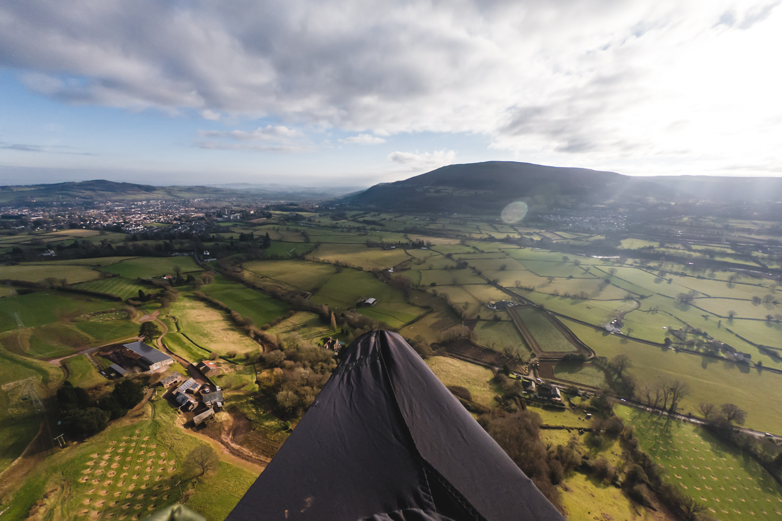
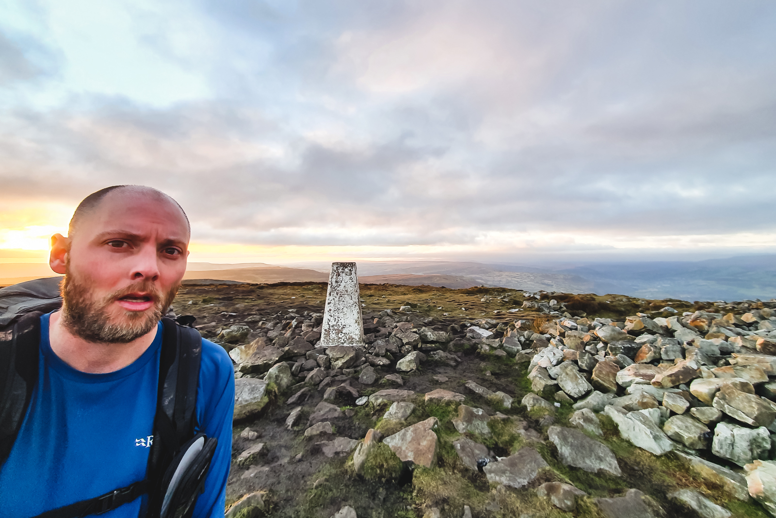
Once getting to the top, it is half a mile to the trig point then half a mile back to launch. The sunset looked incredible – but I needed to get back to the castle before dark! The breeze had picked up, and again was blowing across the hill. I got in the air and cruised down to Castle Meadows.

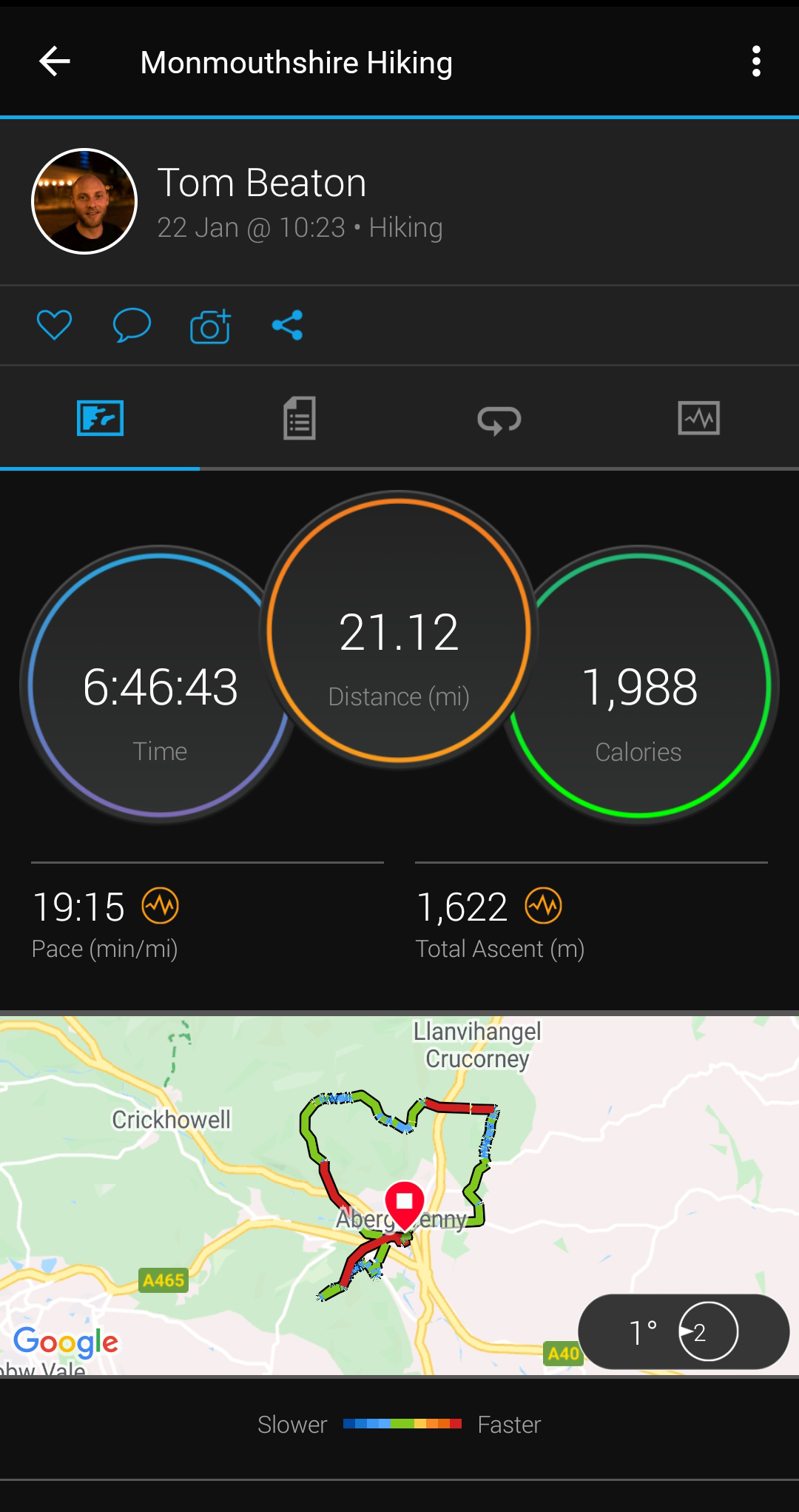
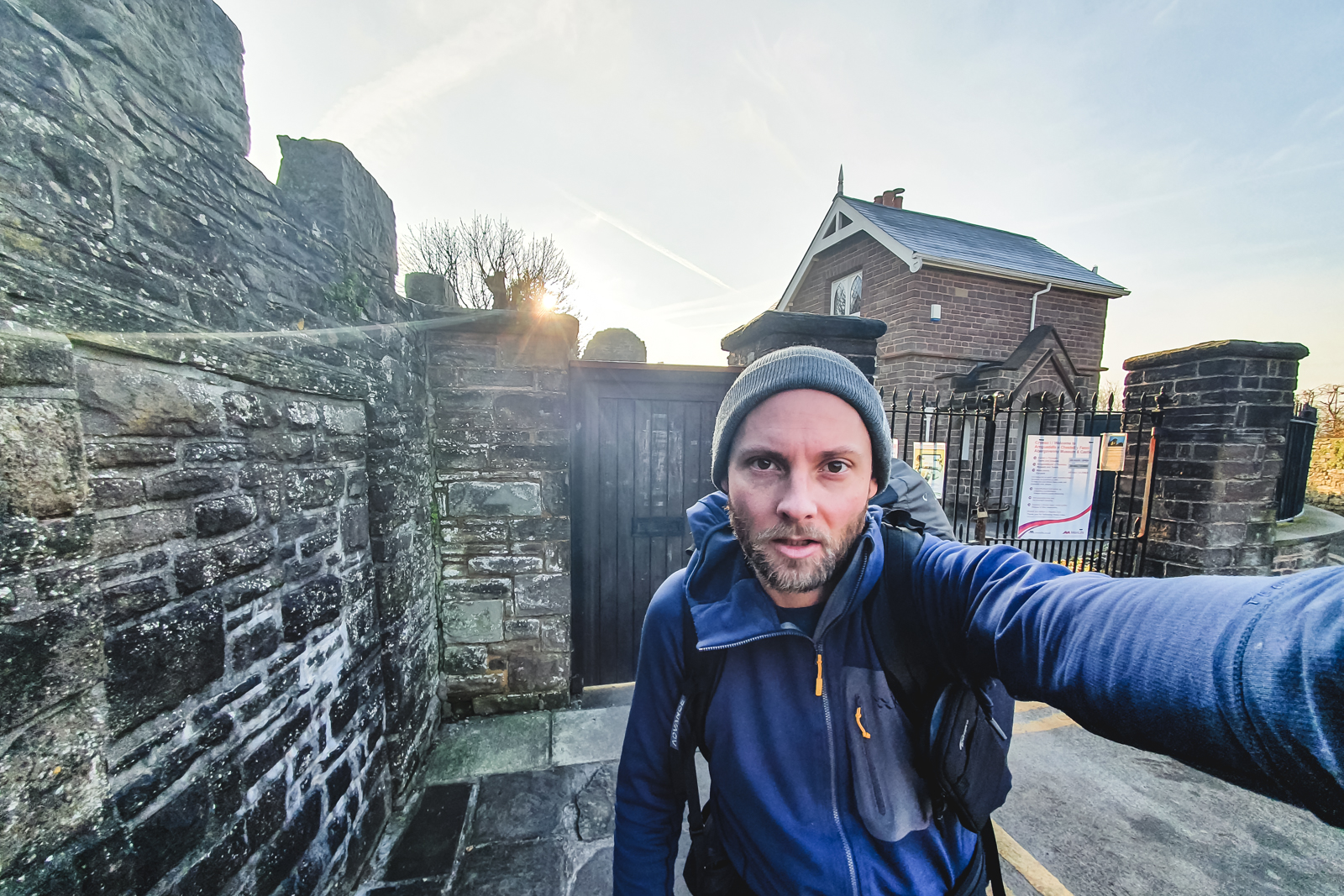
A final packdown and off to the castle. Yet again I got lost and went round the castle the wrong way. Eventually I found the gates and stopped the clock – 6 hours 46 minutes. Exhausted and dehydrated. Plenty of room for improvement.
Well doneTom 🤙
Good stuff Tom!
🪂😃🤙